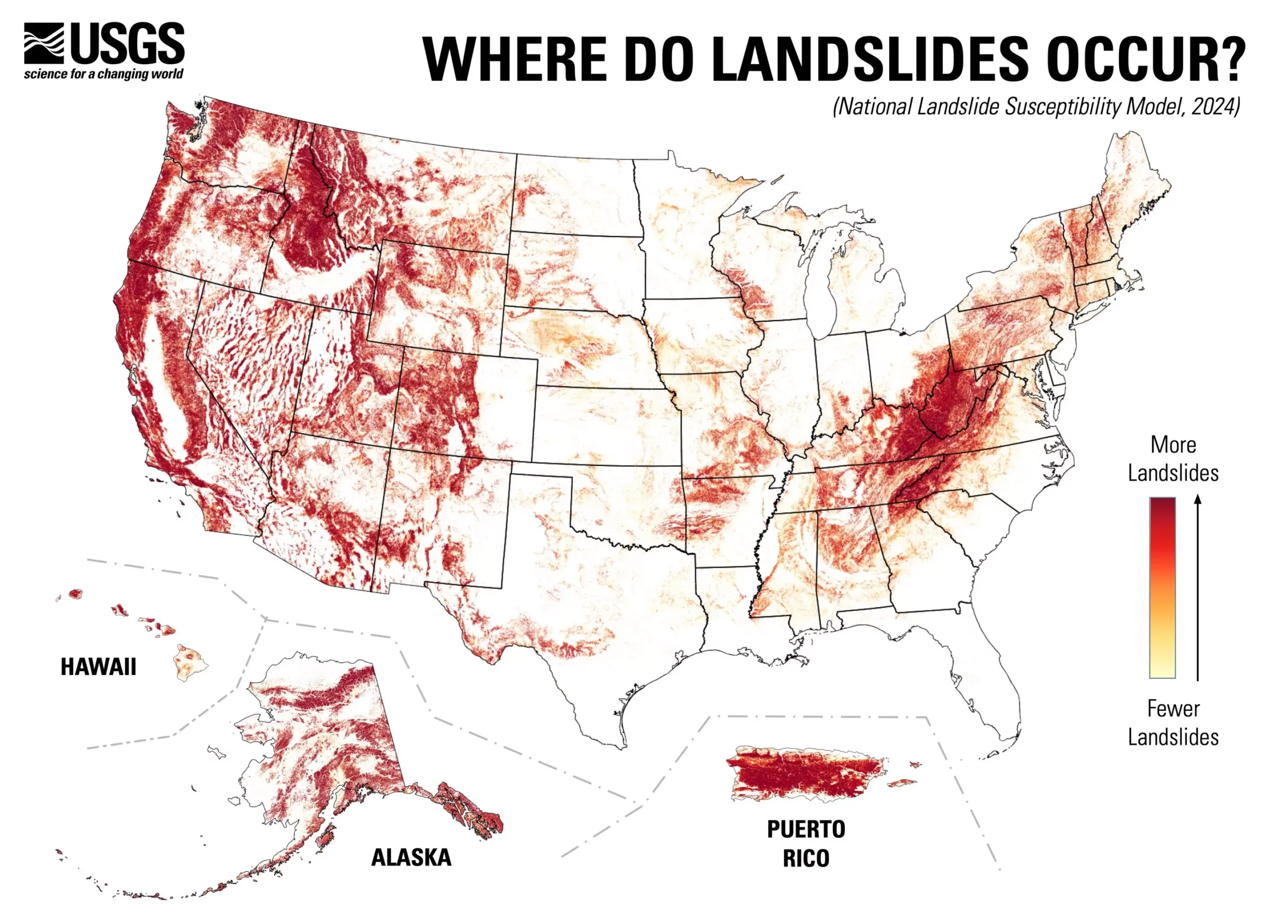
The recent release of a nationwide landslide susceptibility map by the U.S. Geological Survey (USGS) marks a significant advancement in understanding and managing geological hazards across the United States. In a groundbreaking assessment, nearly 44% of the U.S. is identified as potentially susceptible to landslide occurrences. This comprehensive map shifts the paradigm from a limited focus on regions previously labeled as high-risk to a broader understanding that encompasses a multitude of areas across the nation.
Data-Driven Insights
The development of this map is underpinned by a wealth of data, including an inventory of almost one million recorded landslides. By utilizing advanced computing techniques alongside high-resolution national elevation data provided by the USGS 3D Elevation Program, researchers have created a meticulous landslide susceptibility model. This model offers an intricate county-by-county analysis, differentiating between locations where landslide risks are pronounced and those where they are minimal. The robust data foundation enables planners and engineers to identify vulnerable zones effectively, enhancing strategies for risk reduction and land-use planning.
The significance of the new map extends beyond mere assessment; it serves as a practical tool aimed at fostering a more hazard-prepared nation. Research geologist Ben Mirus highlighted the map’s implications for public safety, stating its role in enhancing community preparedness. By making this crucial information publicly accessible, it empowers both individuals and local authorities to anticipate and mitigate the impacts of potential landslides. The clarity offered by the map facilitates improved communication regarding risks and responses, ultimately contributing to community resilience.
Previously, detailed landslide maps were developed selectively for high-risk areas. This recent initiative expands the focus to regions where knowledge about landslide potential was either scarce or non-existent. The map not only identifies current hazards but also serves as a precursor for future investigations. By pinpointing areas that lack detailed landslide mapping, it encourages targeted research efforts, paving the way for better-informed decision-making regarding land use and environmental management.
The USGS’s new nationwide landslide susceptibility map is an invaluable contribution to geological hazard assessment, offering a clearer understanding of landslide-prone areas across the U.S. This pioneering effort exemplifies the intersection of science and community safety, providing stakeholders—ranging from urban planners to emergency responders—with vital information necessary for effective risk management. As awareness of geological hazards continues to evolve, tools like this map will prove crucial in building safer communities that are better poised to respond to the challenges posed by natural disasters.


Leave a Reply