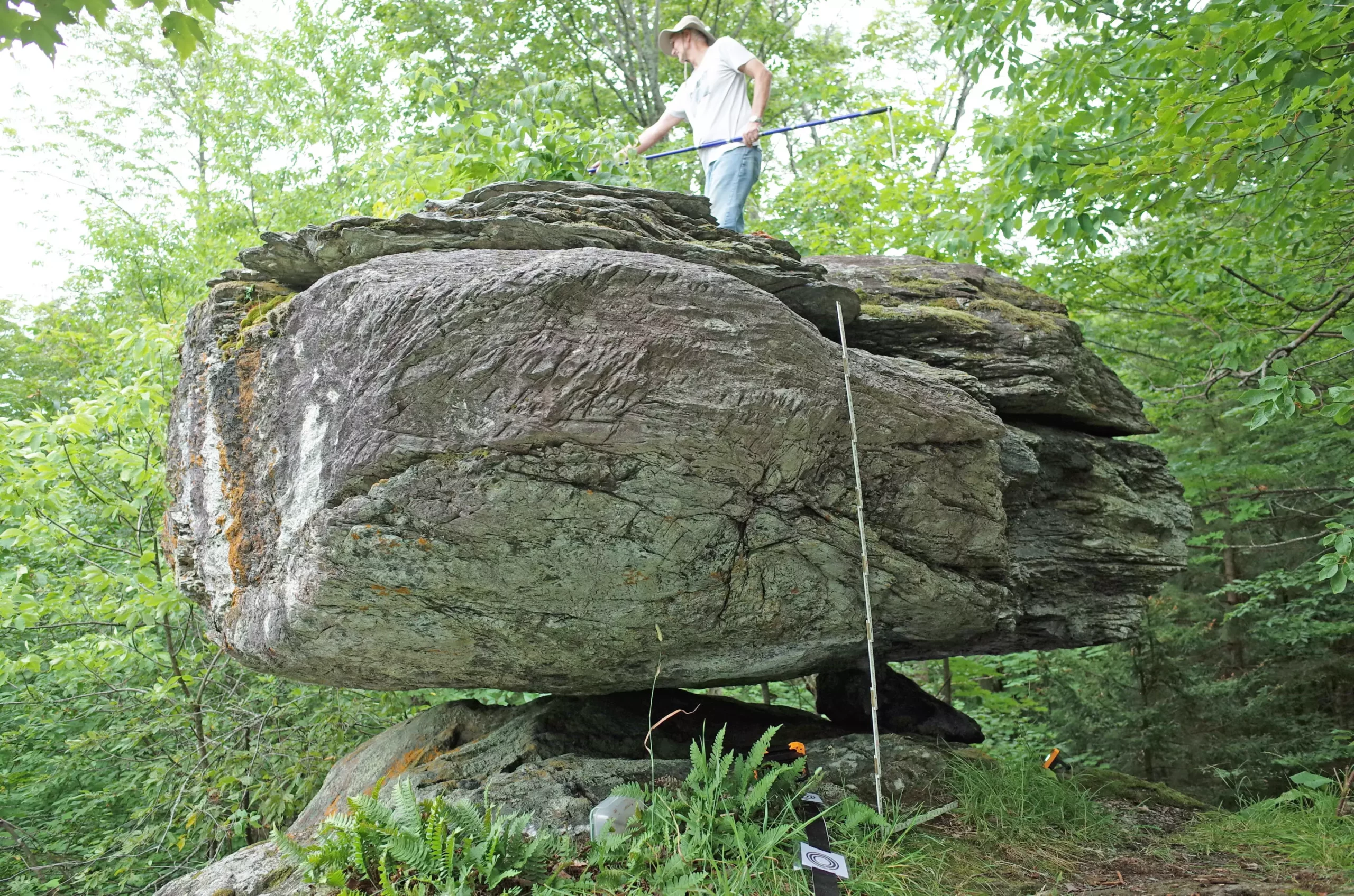
In the realm of geology and seismology, understanding the risks posed by earthquakes is essential, particularly in regions historically prone to seismic activity. A compelling study delves into the glacial erratics of northern New York and Vermont—specifically five boulders precariously balanced on rocky pedestals. These formations, known as Precarious Balanced Rocks (PBRs), are much more than mere geological oddities; they serve as significant indicators of historical seismic activity and the potential for future earthquakes. By examining the fragility of these stones, scientists can glean insights into the intensity of shaking required to dislodge them, which in turn assists in constructing a more accurate seismic hazard model for the area.
Seismologists are tasked with the challenging job of predicting the shaking intensity of earthquakes, and PBRs provide a unique vantage point from which to analyze these forces. With their delicate balance, these boulders serve as geological sentinels that can reflect long-term seismic activity. For instance, a recent study published in the Bulletin of the Seismological Society of America highlights that the data from the five examined PBRs align with the earthquake hazard predictions as outlined by the U.S. Geological Survey’s 2023 National Seismic Hazard Model. This correlation helps confirm ongoing theories about earthquake risk in this under-explored region.
While most of the PBR literature stems from areas like New Zealand and Australia—with a focus on high-risk locations—the research by scientists Devin McPhillips and Thomas Pratt opens new doors for understanding seismic risks in the northeastern United States. Interestingly, while many researchers initially emphasized the study of PBRs resulting from erosion and weathering, McPhillips notes that the northeastern landscape predominantly features glacial erratics, which have their unique characteristics.
Glacial erratics are boulders that ice sheets have transported and subsequently deposited in regions far from their origin. The study’s findings revealed that the five analyzed PBRs have remained intact for approximately 15,000 to 13,000 years, following the retreat of the last ice sheets. This aged fragility poses an interesting paradox — while they serve to record the seismic history of an area, the boulders also inform scientists about the maximum expected shaking that can happen without causing displacement.
The researchers employed advanced technologies such as ground-based lidar in conjunction with field observations to quantify the fragility of the PBRs accurately. They measured parameters such as peak ground acceleration and the relationship between peak ground velocity and peak ground acceleration. These measurements provide crucial data points that allow for calculating the likelihood of a boulder toppling given certain seismic pressures.
To further understand how PBRs contribute to seismic risk assessment, one must consider the historical activity levels in northern New York and northwestern Vermont. The region has experienced notable seismic events, including earthquakes of magnitude 5.0 or greater, such as the Massena quake of 1944 and the Au Sable earthquake of 2002. Additionally, the nearby Western Quebec Seismic Zone has a notable history of significant seismic events. The awareness of such historical seismicity amplifies the importance of PBR studies, as it highlights the potential for future risks.
The research team’s findings align closely with the existing USGS seismic hazard model, indicating that earthquakes in the range of magnitudes 6.5 to 7.0 could occur in these northern regions. Ultimately, understanding the PBRs allows for a better risk assessment and preparedness planning for inhabitants who live in these earthquake-prone areas.
The exploration of PBRs is just beginning, with McPhillips expressing excitement for future discoveries. He is optimistic that more PBRs can be identified, enriching the current dataset and enhancing forecasting accuracy in seismic models. As the field matures, the inclusion of more data points will likely lead to better understanding and preparedness for earthquakes, especially in regions historically overlooked by seismological studies.
The precarious balance of glacial erratics in northern New York and Vermont serves as a vital tool in unearthing the geological past. Not only does this research help in validating existing seismic hazard models, but it also paves the way for future investigations that could reshape our understanding of earthquake risks in the eastern United States. It is a reminder that nature, with its quirks and stability, unveils profound truths regarding the forces that shape our world.


Leave a Reply